
17 de marzo de 2016
Territorial and Maritime Dispute (Nicaragua v. Colombia), 2001
Abstract: The dispute of Nicaragua against Colombia, as any territorial dispute, ends up worsen the jingoisms that cloud one’s judgement, interpreted to its willing; instead of searching for a direct solution based on the objectivity of the law. The article will move through the period in which the dispute arises, the political context prior to the complaint, and so of what was discussed in the process with the purpose to establish that the parties were claiming rights beyond those they really were entitled to, and that the verdict is in accordance with International Law.
Introduction
Any Government that is appealed to a territorial dispute, ends up worsen the jingoisms that cloud one’s judgement, and instead of seeking a direct solution based on the objectivity of the law that assists them, they interpret it to his willing, and therefore delays the solution. The dispute of Nicaragua against Colombia was not the exception, and along these lines in three sections, we will go through a series of facts that denote it.
This document first, goes over the period in which the dispute comes up, demonstrating that the initial discussion focuses on whether the 1928 Treaty came to establish a maritime delimitation. Then, it deals with the political context prior to the complaint of Nicaragua, where it is emphasized that the discussion of the parties was based very little on the law, and therefore goes beyond the maritime boundary.
Finally, it highlights briefly the points discussed in the process that within a legal objectivity framework, will discredit many of the arguments behind the parties to claim rights beyond those they really were entitled to.
- Period of the dispute
On 22 March 1965, the government of Nicaragua issued the Legislative Decree 1068 which established a national fishing zone:
«For a better rational conservation of our fisheries resources and of any other nature, it is set as a national fishing zone the waters between the coast and a parallel to it, 200 nautical miles in both the Atlantic Ocean and in the Pacific”[1]
Meanwhile, on the basis of the Geneva Convention it was proposed the exploration and exploitation of its continental shelf in the Atlantic, hence that on 28 May 1966 the Western Caribbean Petroleum Co., requested and was granted two exploration concessions on that platform. One of those concessions covered the area of Quitasueños, whose depth under the water level makes possible their exploration and exploitation and it would be part of the legal platform in Nicaragua”[2]
The above-mentioned was understood in Colombia as a threat to the country’s sovereignty over the San Andres Archipielago, by issuing an official claim through the Verbal Note dated 4 June 1969 that makes it a «formal declaration of sovereignty in the maritime areas located East of Meridian 82º of Greenwich, and particularly for the effects of exploration or exploitation of the submarine shelf and the living resources of the sea». The Note, among other arguments, says «...the definitive and irrevocable character of the Treaty on Boundaries signed by Colombia and Nicaragua on 24 March 1928″, as well as the clarification stated in the Notes of Exchange of Ratifications of 5 May 1930, «in the sense that the dividing line between respective maritime areas or zones was set at Greenwich Meridian 82º”.[3]
This note answered by Nicaragua on 12 June 1969, is based on the fact that the mentioned Meridian (82° of Greenwich) did not constitute maritime boundary [4]. Since then, part of the debate is focused on the 41 years after the subscription of the Esguerra – Bárcenas Treaty or 39 years from the Exchange of instruments of said Treaty, Nicaragua argued that the Meridian 82° does not set a limit, and Colombia that it does.[5]
Indeed, Nicaragua alleged this in the Memorial presented to the International Court of Justice, however, Colombia argued «that since the conclusion of the agreement reached by the 1928 Treaty and its Protocol of Exchange of Ratifications of 1930, Colombia has always conducted itself as regards the boundary on the basis of what was then agreed». Based the above- mentioned with the Official Map of the Republic of Colombia of 1931 and the official publications entitled “Limits of the Republic of Colombia”, published in 1934 and 1944, in which «the Meridian 82°was likewise incorporated as the border between Colombia and Nicaragua»[6]
Even so, in the early 1970s Colombia designed a foreign policy consistent with the postulates of the defense of sovereignty (which was validated over the years) throughout were negotiated delimitation treaties of marine and submarine areas based on the Meridian 82° West of Greenwich as an «intangible» boundary line with Nicaragua, giving to Colombia a unique presence in the Caribbean sea.
Nevertheless, this policy faced a difficulty to support the thesis of the 82º Meridian as the limit, seeing that Roncador, Quitasueño, and Serrana, were placed to the East of that Meridian and were expressly excluded of the 1928 Treaty, which mentioned in its article 1 °, that these cays were in dispute between Colombia and the United States. Hence, the need to subscribe on 8 September 1972 the Treaty Vasquez-Saccio where the United States of America renounces to all the sovereignty claims over the Roncador, Quitasueño and Serrana. It should be noted that the Treaty Vasquez-Saccio only came into force on 17 September 1981, and as happened in the 1928 Treaty no mention was made to the banks of Bajo Nuevo neither Serranilla.
Treaty with Panama, signed at Cartagena on 20 November 1976, with Exchange of Ratifications on 30 November 1977, it is the most extensive and significant of all with regards to areas that are derived from the contiguity with jurisdiction emanating from both the San Andrés Archipielago and the adjacent mainland coasts.
Treaty with Costa Rica, dated 17 March 1977 was signed in San Jose in order to delimit the maritime areas in the Caribbean, in a small adjacent portion to the already described with Panama. It should be noted that this Treaty has never been ratified by Costa Rica.
«This Treaty weakens the Colombian thesis of the Meridian 82 ° as a limit, since on one hand, the boundary line beyond borders exceeds 14 minutes westwards the restriction imposed on the Exchange of Ratifications of the Treaty Esguerra – Bárcenas; and second, mentions an absence of limit with Nicaragua «… as far as the delimitation should be done with a third State». According to the Cartographic interpretation, Colombia would be implicitly accepting the absence of delimitation in the marine and submarine areas with Nicaragua, at least in the part where the waters are generated by this country, San Andrés and Costa Rica.
Treaties with the Dominican Republic and Haiti, on 13 January 1978 was signed a Treaty of maritime delimitation with the Dominican Republic and one month later, on 17 February with Haiti, while it is true these treaties complement the Colombian jurisdiction on the Caribbean sea, do not have a direct relationship with the issue of Nicaragua.
Treaty with Honduras[7] signed in San Andres 2 August 1986. A Treaty of maritime delimitation, which would generate an angry response from Nicaragua as it has implications on two claims that Nicaragua has advanced to the International Court of Justice; since by one side, Honduras recognized to Colombia the 82nd Meridian as border for the delimitation, as well as the sovereignty over the North cays; and on the other hand, that Colombia acknowledged to Honduras sovereignty until the parallel 15°.
In any case, from the judgments of the International Court of Justice on 8 October 2007 and November 19 of 2012, which resolved the dispute of Nicaragua against Honduras and Nicaragua against Colombia, it was discredit.
Finally, Treaty with Jamaica on 12 November 1993, defines the boundaries with Jamaica, in a more complex way than all previous ones, since it establishes an area of common rules for the exploration and exploitation of natural resources.
- Political Context prior to the demand of Nicaragua
The Sandinista National Liberation Front (FSLN), in June of 1979, ended with more than forty years that the dictatorship of the Somoza family had imposed on Nicaragua. The end of the struggle had the support of a broad and heterogeneous group of leaders who had been consolidated following the murder of journalist Pedro Joaquin Chamorro a year earlier.
To assume the reins of the country, as a government, it made up the «Board of National Reconstruction» with a wide representation of various political groups, which appointed as president one of the main Sandinista leaders: Daniel Ortega Saavedra.
Somoza and his dictatorship, not only had left a political chaos in the country, but an unfortunate economic and social situation. Assignments were multiple and complex and constitute the main challenge in seeking the reconciliation and the national unity.
Within these perspectives, just six months after having taken possession, the Board (and as a proof of the national unity beyond ideologies or political, economic or social differences) approved a decree which declared «null and void» of the Esguerra-Bárcenas Treaty of 1928, and issued a «White Book» containing the claims on the San Andrés, Providencia and Santa Catalina Archipielago, and the Serrana and Roncador, Quitasueño cays.[8]
Nicaragua argued, based on the principle of the rebus sic stantibus, that the circumstances existing at the time of conclusion of the Treaty would create a nullity of it, since the signature in 1928 and the ratification in 1930, were due to reasons of force, as both acts were carried out under the overall political and military occupation of the United States of America.
The Colombian government, dismissed the statement up to the point that the Minister of Foreign Affairs of the time, Diego Uribe Vargas, in a first reaction to the media would ensure that it was «a joke» [9]. However, in December 1980 Colombia would issue the White Book of Colombia in which would lay out its position on the basis of the principle of inviolability of treaties or pacta sunt servanda. [10]
Colombia, in order to ignore the Nicaraguan claim, over the years, clung to the indisputable principle of the inviolability of treaties, understanding that the Esguerra-Bárcenas had settled definitively the allocation and delimitation of the disputed territories, and moreover, that the treaties with Panama, Costa Rica, Dominican Republic, Haiti, Honduras and Jamaica were a recognition of the 82nd Meridian as maritime boundary with Nicaragua. These are undoubtedly, the two most relevant naivety of the Colombian position in this long controversy, first because the treaties do not oblige to the will of the parties but to its content,[11] and because a treaty concluded between two States (such as the treaties that Colombia agreed with other countries in the Western Caribbean) may not affect the rights of third States (Nicaragua).[12] As we will see later, this is the reason that the Court based on for not taking into account the Colombian position with regards to the maritime delimitation.
The national unity that was forged in Nicaragua after the victory of 1979 quickly fell into a crisis that consolidated Ortega and the FSLN in the Government, from where other political sectors were excluded. These new circumstances accelerated the revolutionary processes in other Central American countries, particularly in El Salvador[13] and Guatemala[14]. The conflict in the isthmus became a geopolitical event that threatened to spread to other Latin American countries generating two different international reactions: on one hand, the United States, which promoted a military action against the Sandinista Government in Managua, through the financing, training, logistics and delivery of weapons to a paramilitary group of exiled former somocistas who operated from the military base of Palmerota in the centre of Honduras under the name of » los Contras «. On the other hand, Washington’s militaristic logic objected the mediator management of Colombia, Mexico, Panamá and Venezuela, who from the Contadora Group [15] filed its applications that would be concluded in 1987 with the signing of the Peace Treaty called the «Esquipulas II».
By the early nineties, Central America had achieved a precarious stability, since the processes in El Salvador and Guatemala had not been completed. . Nevertheless, the compliance of the democratic agreements in all the countries would help to consolidate it over the time.
Meanwhile the Central American conflict lasted and Colombia played a role of mediator, negotiator, and tester, the issue of the Nicaraguan claim rested quietly in a drawer of the Foreign Ministry in Managua. But once the hostilities ceased there was a change in the direction of the government of Nicaragua, and the claim of San Andrés reappeared on the agenda.
Two further attempts of negotiation: the first one in 1995 carried out by the Foreign Minister Rodrigo Pardo and the last in 2000 with the Foreign Minister Guillermo Fernández de Soto.[16] The first of these two negotiations failed to be an approach to the theme proposed by the President Violeta Barrios de Chamorro to President Ernesto Samper, during a meeting in the framework of a multilateral conference, which would end a few days later when the Minister Pardo announced that there was nothing to discuss about the matter[17]. There would be a new freeze of the issue, until 1999 when the Government of Honduras ratified the Treaty of Limits with Colombia in 1986, named «López Contreras-Ramírez Ocampo», and that would led the Government of President Arnoldo Alemán Lacayo to declare that the possibilities of a direct agreement ended and the case would be brought to the International Court of The Hague.
The latter approach was the cause of a heated debate between the advocates of the two countries, during the public hearings that took place in The Hague to define the Preliminary Objections in June 2007, and its main protagonist was the Colombian ex Chancellor Guillermo Fernández de Soto. According to the version included to the process in the form of Affidavit by the ex Chancellor of Nicaragua Francisco Aguirre Sacasa[18] (who was legally attacked by the Colombian Defense), in 2001 the Colombian Minister would have created spaces of negotiation that were interpreted by his counterpart as a mechanism to avoid that the Managua Government file the application to the ICJ, and thus gain time to withdraw the unilateral declaration accepting the compulsory jurisdiction of the Court, 1937. For the Colombian defense, such allegation was unacceptable.[19]
True or not the Nicaraguan statements, within 24 hours that Nicaragua filed the application at the Court in The Hague, the Colombian Government in a Diplomatic Note signed by the Foreign Minister Fernandez de Soto dated 5 December 2001, in Paris; and addressed to the General Secretary of the United Nations, Kofi Annan, formally announced the withdrawal of the note of unilateral acceptance of the compulsory jurisdiction of the International Court of Justice which was force since 1937.
- Key points debated in the process
On 6 December 2001, Nicaragua filed in the registry of the Court an application against Colombia based in a legal dispute regarding the titles of certain territories in the Western Caribbean and the maritime delimitation.
Nicaragua understands that the Court has compulsory jurisdiction in accordance with article XXXI of the American Treaty on Pacific solutions, of 30 April 1948 (Pact of Bogotá), and with the statements made by the parties under article 36 of the Statute of the Permanent Court of International Justice.
The Court fixed 28 April 2003 as the deadline for the filing of the Memorial of Nicaragua and 28 June 2004 as the deadline for the filing of the Counter-Memorial of Colombia.
Once the Memorial of the Government of Nicaragua was filed, Colombia presented the Preliminary Objections on 21 July 2003, as a result, the Court set to Nicaragua the deadline on 26 January 2004 for the submission of written comment on the Preliminary Objections. Deposited these observations the Court proceeded to hold hearings.
From 4 to 8 June 2007, there were public hearings on the preliminary objections raised by Colombia, and the Court concluded in its judgment of 13 December 2007 that it had jurisdiction under the article XXXI of the Pact of Bogotá, to judge on the dispute concerning the sovereignty of maritime features claimed by the parties other than the islands of San Andrés, Providencia and Santa Catalina and the dispute concerning the maritime delimitation.[20]
Thus, the Court considered that, in the light of the article I of the Esguerra – Bárcenas Treaty it was clear that sovereignty over the islands of San Andrés, Providencia and Santa Catalina had been resolved, discrediting the Nicaraguan argumentation with regards to the invalidity of the Treaty based on the circumstances existing at the moment of its conclusion (signature in 1928 and the ratification in 1930).[21]
In turn, based on the validity of the Esguerra Bárcenas Treaty it also will undermine the Colombian argument due to the fact that everything relative to the entire maritime features claimed by the parties and the maritime delimitation had already been solved. The Court was explicit in its judgment, noting that in the light of articles VI and XXXIV of the Pact of Bogota only was closed «forever» the matter relating to the territories of the islands of San Andrés, Providencia and Santa Catalina.[22]
As far as the above mentioned is concerned, the Court emphasizes that the meaning of the second paragraph of article I of the 1928 Treaty is clear, since this Treaty expressly exclude the issue of sovereignty over Roncador, Quitasueño, and Serrana. Therefore, the limitations contained in article VI of the Pact of Bogota do not apply to the question of sovereignty over those territories. Similarly, the Court concludes that the 1928 Treaty and its 1930 Protocol did not carry out a general delimitation of the maritime boundary between Colombia and Nicaragua.
Thus, based on the Pact of Bogotá, the Court ties the resolution of the Preliminary Objections to the merits of the case, without ruling by the sudden and naive withdrawal made by Colombia a day before the presentation of Nicaragua’s Application of the unilateral declaration of competence issued in 1937.[23]
Resolved the exceptions, a new deadline for the filing of the Counter-Memory of Colombia, was fixed on 11 November 2008 request that was attended in due term. The rejoinders of Nicaragua and Colombia were filed within the fixed time, that is, on 18 September 2009 and on 18 June, 2010 respectively. For connoisseurs, it was clear that from this procedural stage, there was little more that Colombia could win . The recognition of sovereignty over San Andres, Providencia and Santa Catalina would be added based on the same principles of the ruling in the case of Nicaragua vs. Honduras; the recognition of sovereignty over Roncador, Serrana, Albuquerque and the East cays, to which the Court will fix them a portion of the territorial sea, and as the Court had already warned, in any case it would be no more than 12 nautical miles, and the fate of Quitasueño, would depend to be considered landmass. [24]
On 25 February 2010 and 10 June 2010, respectively Costa Rica and Honduras filed applications to be allowed to participate in the case as intervening party, based on the article 62 of the Statute of the Court. However, in separate statements issued on 4 May 2011, the Court denied such claims.[25]
Public hearings were held between 23 April and 4 May 2012, in which the Court heard arguments and responses of the parties.
In its judgment of 19 November 2012, the International Court of Justice, makes an analysis of the maritime features in dispute, to determine if they are capable of appropriation, the Court recalls the regime of the Islands, it refers to the low-tide elevations, it stops in the matter of Quitasueño, discussing the Smith report, the tide models, and based on these, states that the point QS32 in Quitasueño is the only outstanding formation at high-tide.[26]
Moreover, it resumes the debate of the 1928 Treaty between Nicaragua and Colombia and the 1930 Protocol, referring to what has already been pronounced in its judgment on the Preliminary Objections in 2007. In turn, states that the full composition of the Archipelago cannot be established according to the basis of the 1928 Treaty.[27]
With regard to the Uti Possidetis Juris, emphasizes that the maritime features were not clearly attributed to the provinces of Nicaragua or of Colombia prior to or upon its independence, and therefore, neither Nicaragua nor Colombia has established a title by virtue of this principle.[28]
In terms of Effectivités, it points out the absence of these by Nicaragua and the different categories presented by Colombia. In addition, it refers to the continuous and consistent acts “au titre de souverain” carried out by Colombia, the absence of objection from Nicaragua; prior to the critical date; Nicaragua’s reaction to the Loubet Award, and its absence of claim of sovereignty with regards to Roncador, Quitasueño, and Serrana in the time of the 1928 Treaty. It even mentions the practices of third States and that the maps tend to strengthen the position of Colombia. Hence, the Court will not hesitate to point out that Colombia has sovereignty over the maritime features in dispute.[29]
It accepts, the claim of Nicaragua for delimitation of a continental shelf extending beyond 200 nautical miles as a new application, whenever the original complaint concerned to the delimitation of the exclusive economic zone and the continental shelf, hence it considers that this new claim, arises directly from the dispute by the maritime delimitation and do not transforms the subject-matter in dispute.[30]
Notwithstanding the foregoing, the pretension of Nicaragua for a delimitation of the continental shelf extending beyond 200 nautical miles, cannot be proceeded since, the claim for an extended continental shelf by a State Member of the United Nations Convention on the Law of the Sea (UNCLOS) should be in accordance with the article 76, and Nicaragua is not relieved of its obligation of having the preliminary report of the Commission on the limits of the continental shelf.[31]
Then, the Court proceeds to the delimitation of the maritime boundary, delimiting the continental shelf and the Nicaraguan exclusive economic zone, as well as the continental shelf and the exclusive economic zone generated by the Colombian Islands, based on the customary International Law applicable and reflected in the articles 74 and 83 (maritime delimitation) and article 121 (legal regime of Islands) of the UNCLOS.[32]
In its task of delimitation, the Court refers to the relevant coasts: the continental coast of Nicaragua and the entire coastline of the Colombian islands, pointing out that in the case of the latter, the coastal line of Serranilla, Bajo Nuevo and Quitasueño are not part of the relevant coast[33]. Thus, the lengths of the relevant coasts totalling therefore, 531 km (Nicaragua) and 65 km (Colombia) in a ratio of approximately 1:8.2 in favour of Nicaragua.[34]
To determine the relevant maritime area it takes into account the entitlements generated by the maritime features of San Andrés, Providencia and Santa Catalina, considering that they are entitled to a territorial sea, exclusive economic zone and continental shelf; and with regards to Roncador, Serrana, Alburquerque and the East and Southeast cays these ones are each entitled to a territorial sea of 12 nautical miles, in the same way as Quitasueño. It excludes to mention Serranilla and Bajo Nuevo for not being relevant in the delimitation.[35]
Based on the foregoing, and in accordance with the relevant maritime area, it extends 200 miles from Nicaragua, North of Providence and Roncador, doing the same to the South of Albuquerque and the East and Southeast cays. In the Northern Corridor, the exploitation rights of Nicaragua, are limited by the enclave of Quitasueño and Serrana featuring around with their respective 12 nautical miles of territorial sea.[36]
The method of delimitation used by the Court, was to construct a provisional equidistance/ median line between the Nicaraguan coast and the west-facing coasts of the relevant Colombian Islands, which was then adjusted or shifted under relevant circumstances so required due to the substantial disparity in length of the coastline. At last, it carried out a disproportionality test, which concluded that there was no need to apply a principle of strict proportionality so that it does not create an inequitable result.[37]
Finally, with regards to the request of Nicaragua in an statement on Colombia’s illegal conduct, the Court found it baseless, since the stipulated maritime delimitation does not grant to Nicaragua the whole of area which it claims.[38]
Conclusions:
The controversy is established in 1969, by virtue of the claim through a Verbal Note from Colombia on June 4, which considered the fact that the Meridian 82° West is the maritime boundary on the basis of the 1928 Treaty and its 1930 Notes of Exchange. For its part, Nicaragua replied on June 19, rejecting that argument and alleging that four decades after the 1928 Treaty and its Notes of Exchange the Colombian thesis arises.
Established the dispute, Colombia begins to negotiate treaties of maritime delimitation with third parties based on the Meridian 82º as intangible boundary in front of Nicaragua. For its part, Nicaragua in 1980 declared null and void the 1928 Treaty, and based on this, not only claims the absence of maritime delimitation with Colombia, but also the allocation of territories.
Few attempts of negotiation, with limited political disposition – especially from Colombia – lead Nicaragua to file the application against Colombia at the International Court in 2001. Colombia refutes the competition of the Court, and so in the process that resolved these preliminary objections, the Nicaraguan thesis of nullity of the 1928 Treaty was rejected as well as the arguments of Colombia that the Treaty had resolved the allocation of territories and the maritime delimitation. In its judgment of 2007; the Court pointed out that in view of the articles VI and XXXIV of the Pact of Bogotá only left settled the matter relating to the territories of the islands of San Andrés, Providence and Santa Catalina, and hence under the same Pact of Bogotá was competent.
The procedure and judgment on the merits passing through the debate of the maritime features to know if they are capable of appropriation, concluding that they are, that it is not feasible to decide on the basis of Uti Possidetis Juris since they were not attributed prior to the independence of Nicaragua and Colombia, and therefore it is based on the Effectivités. Thus, it refers to the continuous and consistent acts “au titre de souverain” carried out by Colombia, moreover, the absence of objection of Nicaragua.
The Court also considers that San Andres, Providencia and Santa Catalina are entitled generators to a territorial sea, exclusive economic zone and continental shelf, and with regards to Roncador, Serrana, Alburquerque and the East and Southeast cays these ones are each entitled to a territorial sea of 12 nautical miles, in the same way as Quitasueño. The Court excludes to mention Serranilla and Bajo Nuevo for not been relevant in the delimitation.
It delimits, constructing a provisional median line between the Nicaraguan coast and the west-facing coasts of the relevant Colombian Islands, which was then adjusted or shifted under relevant circumstances due to the substantial disparity in length of the coastline, without applying a principle of strict proportionality so that it does not create an inequitable result.
It extends 200 miles from Nicaragua to the North of Providence and Roncador and South of Albuquerque and the East and Southeast cays. In the Northern Corridor, the exploitation rights of Nicaragua, are limited by the enclave of Quitasueño and Serrana featuring around with their respective 12 nautical miles of territorial sea.
A significant majority in Colombia has been interpreted, as a defeat -even unlawful – the resolution of this dispute with Nicaragua, despite the failure – in our view – it is in law and the Colombian thesis do not succeed because the treaties do not bind in accordance to the will of the parties but to its content and -the most obvious thing – to conclude treaties, such as those made by Colombia with other countries in the Western Caribbean, could not affect the rights of Nicaragua.
Bibliography
Cavelier, G. y Lozano Simonelli A. El ataque de Nicaragua a la soberanía colombiana. University of Bogotá Jorge Tadeo Lozano, 2005.
I.C.J. Application Instituting Proceedings filed in the Registry of the Court on 6 December 2001, Territorial and Maritime Dispute (Nicaragua v. Colombia).
I.C.J. Memorial of the Goverment of Nicaragua of 28 April 2003, Territorial and Maritime Dispute (Nicaragua v. Colombia).
I.C.J. Preliminary Objections of the Goverment of Colombia, Territorial and Maritime Dispute (Nicaragua v. Colombia), July 2003, Vol I.
I.C.J. Written Statement of the Government of Nicaragua about Preliminary Objections of 26 January 2004. Territorial and Maritime Dispute (Nicaragua v. Colombia), Vol I.
I.C.J. Public sitting held on Wednesday 6 June 2007, at 4 p.m., at the Peace Palace, President Higgins presiding, Territorial and Maritime Dispute (Nicaragua v. Colombia), Verbatim record 29.
Lacleta J.M. Enclave Colonialista Colombiano en nuestra Plataforma Nicaragüense, Elcano Institute. Available: http://www.manfut.org/cronologia/caribenica.html (accessed 20 May 2105).
Lozano Simonelli, A. La Amenaza de Nicaragua, University of Bogotá Jorge Tadeo Lozano, Bogotá, 2002.
Ministry of Foreign Affairs of Colombia. Libro Blanco de la República de Colombia, 1980. Available http://www.sogeocol.edu.co/documentos/Lib_Blanco.pdf (accessed 1 June 2015).
Salgar, C. and Tremolada E. “El Caribe Occidental en la Corte Internacional de Justicia. Commments to the latter decisions of the Court to the applications filed by Nicaragua against Honduras and Colombia”, Magazine Derecho del Estado, N° 21, Law Faculty, Department of Constitutional Law, University Externado of Colombia, Bogotá, 2008, 223-246.
Territorial and Maritime Dispute (Nicaragua v. Colombia), Judgment, I.C.J. Reports 2012.
Territorial and Maritime Dispute (Nicaragua v. Colombia), Preliminary Objections, Judgment, I.C.J. Reports 2007.
Territorial and Maritime Dispute between Nicaragua and Honduras in the Caribbean Sea (Nicaragua v. Honduras), Judgment, I.C.J. Reports 2007.
Tremolada, E. A un año del fallo de La Haya: ¿derecho o chauvinismo? Ámbito Jurídico. Edition 383, section Analysis, Bogotá, 29 November 2013.
Tremolada, E.“Colombia vs. Nicaragua. ¿Perderá Colombia las excepciones en su disputa territorial y marítima?”, Zero Magazine, n.º 19, Bogotá, University Externado de Colombia, 2007, 106-111.
University of Chile, Anales de la Facultad de Derecho, Fourth Epoque, vol. XII, Nº 12, 1971.
[1] University of Chile, Anales de la Facultad de Derecho, Fourth Epoque, vol. XII, Nº 12, 1971
[2] Lacleta J.M. Enclave Colonialista Colombiano en nuestra Plataforma Nicaragüense, Instituto Elcano. Available: http://www.manfut.org/cronologia/caribenica.html (accessed 20 May 2105).
[3] I.C.J. Memorial of the Goverment of Nicaragua of 28 April 2003, Territorial and Maritime Dispute (Nicaragua v. Colombia), Vol I, page 154, paragraph 2.204.
[4] The Court observes that there is no indication that there was a dispute before the 1969 Notes of Exchange mentioned by Nicaragua. Moreover, Colombia does not seem to contest the critical date. In light of the above the Court concludes that 12 June 1969, the date of Nicaragua’s Note in response to Colombia’s Note of 4 June 1969, is the critical date for the purposes of appraising effectivités in the present case. Territorial and Maritime Dispute (Nicaragua v. Colombia), Judgment, I.C.J. Reports 2012, paragraph 71
[5] Cavelier, G. y Lozano Simonelli A. El ataque de Nicaragua a la soberanía colombiana. University of Bogotá Jorge Tadeo Lozano, 2005, p. 407.
[6] I.C.J. Preliminary Objections of the Goverment of Colombia, Territorial and Maritime Dispute (Nicaragua v. Colombia), July 2003, Vol I, page 57, paragraphs 1.91 and 1.92
[7] From the judgment of the International Court of Justice of 8 October 2007, which resolved the maritime delimitation between Honduras and Nicaragua, most of the boundary segments established in this Treaty that belonged to Honduras remained under Nicaraguan sovereignty. Territorial and Maritime Dispute between Nicaragua and Honduras in the Caribbean Sea (Nicaragua v. Honduras), Judgment, I.C.J. Reports 2007.
[8] It should be noted that in 1977, the Government of Somoza, promoted a meeting between Colombian Ambassador Julio Londoño Paredes and the Nicaraguan Foreign Minister Alejandro Montiel Argüello. I.C.J. Written Statement of the Government of Nicaragua about Preliminary Objections of 26 January 2004. Territorial and Maritime Dispute (Nicaragua v. Colombia), Numeral 1.67, page 40.
[9] According to Lozano Simonelli review in his book La Amenaza de Nicaragua, Jorge Tadeo Lozano, Bogotá, September 2002, page. 278.
[10] Ministry of Foreign Affairs of Colombia. The White Book of the Republic of Colombia, 1980. Available http://www.sogeocol.edu.co/documentos/Lib_Blanco.pdf (accessed 1 June 2015).
[11]Tremolada, E. A un año del fallo de La Haya: ¿derecho o chauvinismo? Ámbito Jurídico. Edition 383, section Analysis, Bogotá, 29 November 2013.
[12] The Court dismissed the Colombian argument of the Treaties of Limits in the Western Caribbean on the basis in one of the basic principles of the International Law, that establishes that a Treaty concluded between two States may not affect the rights of third States. It adduces the arbitral awards in the Island of Palmas case, «it is evident, regardless of what might be the proper interpretation of a Treaty, that this cannot be interpreted in a way that has the rights of the third independent States (…) Revue générale de droit international public (RGDIP), t. XLII, 1935, page. 168”. Territorial and Maritime Dispute (Nicaragua v. Colombia), Judgment, I.C.J. Reports 2012, paragraph 227.
[13] The National Liberation Front Farabundo Martí (FMLN) would be the other main protagonist of the Central American process in the early 1980s, and in their struggle came to the same capital of the country. The peace processes derived from Esquipulas in El Salvador allow to be given a successful programme of reintegration to the political life of the country of the members of the FMLN.
[14] The Guatemalteca National Revolutionary Union (URNG), formed by the union of three different guerrilla groups, would also have a bumpy peace process that lasted until the 1990s. Unlike the groups that operated in El Salvador and Nicaragua, the URNG failed to become an active political party in the country.
[15] The Contadora Group thus initially formed would be expanded with the «support group to Contadora»: Brazil, Argentina, Uruguay and Peru. These eight countries would continue united in a group of queries and iti would be extended to all other countries of Latin America, eventually change its name, today is called Rio Group.
[16] I.C.J. Written Statement of the Government of Nicaragua about Preliminary Objections of 26 January 2004, Territorial and Maritime Dispute (Nicaragua v. Colombia),Vol I, pp. 44 y ss.
[17] I.C.J. Application Instituting Proceedings filed in the Registry of the Court on 6 December 2001, Territorial and Maritime Dispute (Nicaragua v. Colombia), Numeral 1.79, p. 45.
[18] I.C.J. Memorial of the Goverment of Nicaragua of 28 April 2003, Territorial and Maritime Dispute (Nicaragua v. Colombia), Vol I, paragraph 1.68 y ss., pp. 41 y ss.
[19] I.C.J. Public sitting held on Wednesday 6 June 2007, at 4 p.m., at the Peace Palace, President Higgins presiding, Territorial and Maritime Dispute (Nicaragua v. Colombia), Verbatim record 29, numeral 55.
[20] Territorial and Maritime Dispute (Nicaragua v. Colombia), Preliminary Objections, Judgment, I.C.J. Reports 2007, p. 876, paragraph 142 (3).
[21] The Court emphasizes that for more than 50 years Nicaragua has considered the 1928 Treaty as valid and during this period of time never claimed that it was bound by it, even after the withdrawal of the last troops of the United States in early 1933. Ibidem, p. 26, paragraph. 79.
[22] Ibidem, p. 28, paragraph 88.
[23] We did not understand this naive strategy, moreover, when within the Colombian counsellors-advocates was the former Judge and President of the International Court, Stephen M. Schwebel, who failed to succeed the American thesis of incompetence of the International Court based on a similar withdrawal on the issue of paramilitary activities in and against Nicaragua, «… the issue of what is a reasonable period of notice should be legally required does not need much analysis: It is only necessary to be observed that from 6 to 9 April there is no term that could be viewed as a reasonable time». Would it be that the Colombian defense expected a withdrawal of less than 24 hours as reasonable time, when four days had not been enough? Did Colombia know that in 1998 such reasoning was further consolidated when the Court ruled on the Preliminary Objections in the case of land and maritime boundary between Cameroon and Nigeria? The questions increase if we bear in mind that, Arthur Watts, also at that time counsellor-advocate of Colombia, published together with Jennings the classic manual of Oppenheim’s International Law, where there is a footnote referring to the reasonable term of issue of paramilitary activities in and against Nicaragua, quoting the advisory opinion of the Court, pronounced in 1980 within the case of the Regional Office of the World Health Organization in Egypt, that pointed as a reasonable period of minimum 12 months. See in full Tremolada, E. “Colombia vs. Nicaragua. ¿Perderá Colombia las excepciones en su disputa territorial y marítima?”, Zero Magazine, n.º 19, Bogotá, University Externado of Colombia, 2007, 106-111
[24] See in this regard Salgar, C. and Tremolada E. “El Caribe Occidental en la Corte Internacional de Justicia. Commments to the latter decisions of the Court to the applications filed by Nicaragua against Honduras and Colombia”, Magazine Derecho del Estado, N° 21, Law Faculty, Department of Constitutional Law, University Externado of Colombia, Bogotá, 2008, p.244
[25] Territorial and Maritime Dispute (Nicaragua v. Colombia), Judgment, I.C.J. Reports 2012, paragraph 10
[26] Ibidem, paragraphs 25 to 38
[27] Ibidem, paragraphs 40 to 56
[28] Ibidem, paragraphs 57 to 65
[29] Ibidem, paragraphs 66 to 90
[30] Ibidem, paragraphs 104 to 126
[31] Ibidem, paragraphs 127 to131
[32] Ibidem, paragraphs 132 to 139
[33] It should be recalled that Serranilla and Bajo Nuevo have a common regime for the exploration and exploitation of natural resources under the Treaty of Colombia with Jamaica of 12 November 1993, and due to its location it does not affect the Nicaraguan rights.
[34] Territorial and Maritime Dispute (Nicaragua v. Colombia), Judgment, I.C.J. Reports 2012, paragraphs 140 to 154
[35] Ibidem, paragraphs 155 to 166
[36] Ibidem, paragraphs 167 to 183
[37] Ibidem, paragraphs 184 to 247
[38] Ibidem, paragraphs 248 to 250
Artículos Recientes
¡Ya está disponible el caso! Segunda versión del Concurso Laboratorio de Estrategia Legal #LSL
Invitamos a los estudiantes de pregrado y postgrado de todas las carreras a presentar [...]

Masterclass Legal Operations: Transformando la Función Legal Empresarial de Guardián de Riesgos a Creador de Valor.
El Departamento de Derecho de los Negocios y la Facultad de Administración de Empresas [...]

Conclusión del Proceso de Reforma al Investor-State Dispute Settlement
En la semana del 12 de julio de 2023, durante la sesión anual de [...]
El Departamento de Derecho de los Negocios de la Universidad Externado de Colombia abre convocatoria para la vacante de Asistente de Investigación
¡Sé parte de nuestro equipo de trabajo! Perfil del cargo: Asistente de Investigación Apoyar [...]

Docente del Departamento de Derecho de los Negocios participó en el libro Blanco de la Asociación de Derecho Internacional
La Asociación de Derecho Internacional (ADI), una de la organizaciones más antiguas y prestigiosas [...]

CRYPTO IN COLOMBIA: PROSPECTIVE 2022
By: Daniel Peña Valenzuela The volatility of the main cryptocurrencies seems to be once [...]

Convocatoria de Monitores.
El Departamento de Derecho de los Negocios se complace en anunciar la apertura para [...]

¿Se avecina una regulación de la Franquicia por parte del Gobierno? ¿O lo impedirá la Corte Constitucional?
Por: Juan Miguel Álvarez* y Diana Marcela Araujo* En diciembre del 2020, el congreso [...]
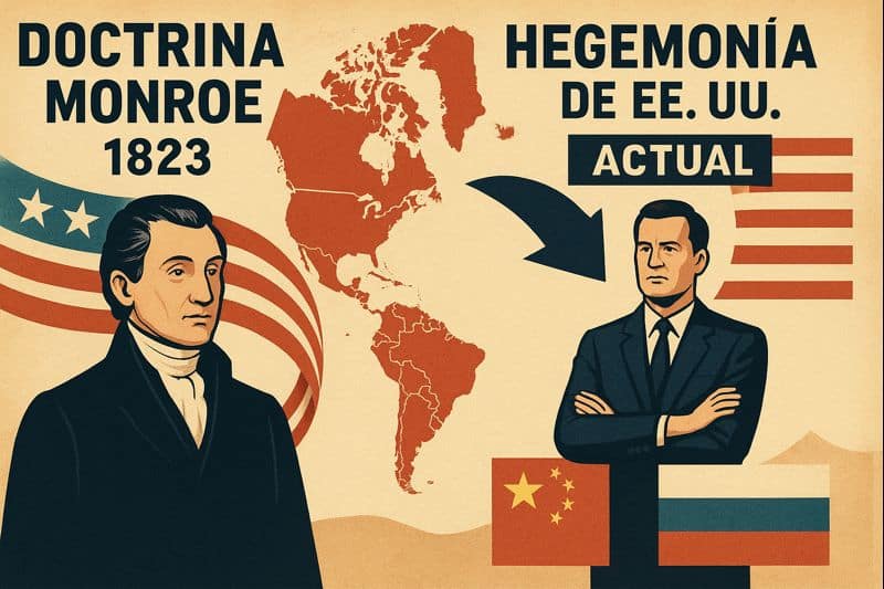
¿Doctrina Neo-Monroe?
La Doctrina Monroe, que en 1823 advertía a los poderes europeos no intentar la [...]

Clase de Matemáticas Financieras en la Esp. Derecho de los Negocios
El departamento de Derecho de los Negocios extiende una invitación especial a todos los [...]
Primera visita de la Especialización en Innovación Legal (2025-2026)
El departamento de Derecho de los Negocios agradece a los estudiantes de la VI promoción [...]

¡Vuelve el Concurso estudiantil Legal Strategy Lab!
Los Departamentos de Derecho de los Negocios y Derecho Civil de la Universidad Externado [...]